BBKTA Land Use Survey
CLIENT: Bakgatla Ba Kgafela Traditional Administration
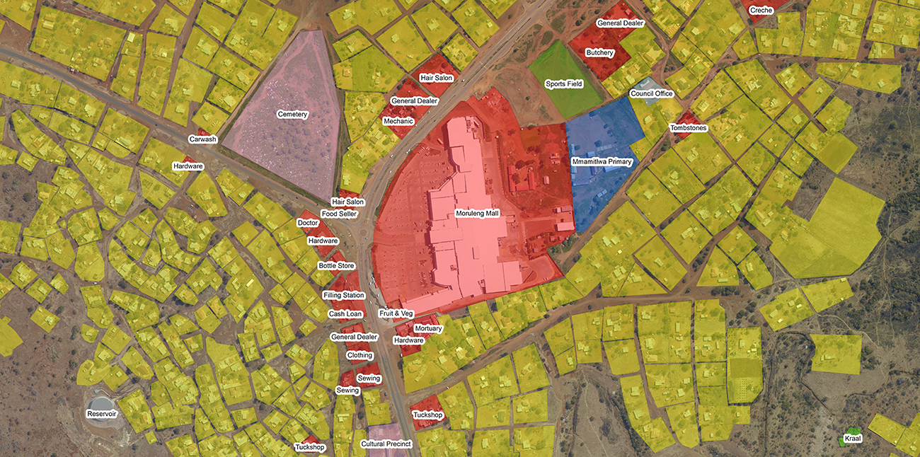
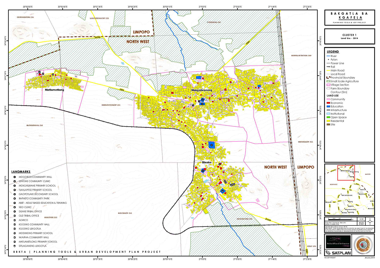
The BBKTA Land Use Survey was undertaken as a component of the BBKTA Planning Tools & Urban Development Plan Project during 2014. The Survey was implemented in conjunction with local BBKTA youth (“Community Ambassadors”) and local village headsmen (“Dikgosana”).
Combining a hybrid of ground survey techniques e.g. map marking, mobile GIS and survey questionnaires, the BBKTA Land Use Survey serves as the first comprehensive land use audit initiated by the BBKTA for the 32 villages under its jurisdiction.
The Objectives Of The Survey Were To:
- Distinguish land use within BBKTA villages
- Compile a contact register of businesses and community facilities in the BBKTA area
- Gauge the nature and extent of business activity in the BBKTA area
- Understand the development challenges and aspirations of businesses and community-related facilities in the BBKTA area
- Compile an accurate digital record of BBKTA village land use for development planning and the BBKTA Land Use Management System (LUM)


